Road inspection

Geophysical surveys are an integral part of engineering geophysical surveys for highways. The application of nondestructive methods of roadway control, seasonable territory surveys in designing and constructing highways makes it possible to minimize the risk of operation problems.
GEOTECH has the unique experience of providing engineering geophysical surveys in road control analysis and in designing and construction of new routes. On conducting surveys it is used domestic manufacture technique which makes it possible to conduct works at a rate up to 80 kilometers per hour.
APPLICATIONS
Engineering geophysical surveys for highways and overbridges construction
Determining thickness of road pavement structural layers
Detection of subsidence
Detection of nonsolid and watered zones
Study of engineering geological conditions of the zones liable to deformation:
•determining occurrence level of subsoil water existence
•mapping of bedrock foundation roof
•locating zones of specific subsoil spread (peat, silt, salt subsoil etc.)
•permafrost top tracing
•detection of heavy icy rocks
•examination of taliks, supercooled water brines with permafrost
•examination of permafrost dynamics (seasonal freezing zones)
Mapping of underground utility lines
Study of dangerous engineering geological processes:
•landslides,
•floating earth,
•karstic phenomena
Checking highway pavement structure compliance with project documentation
-
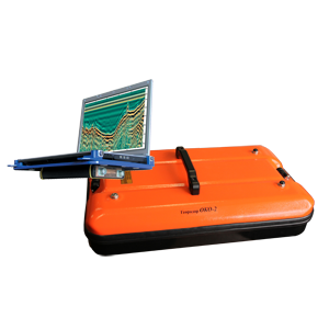
OKO-3 GPR with a control unit
The OKO-3 GPR is a portable lightweight low-prices system designed for non-destructive environmental monitoring. The OKO-3 GPR includes the control unit and antennas. All antennas are interchangeable and meet the needs of a broad range of applications. The control unit is...
-
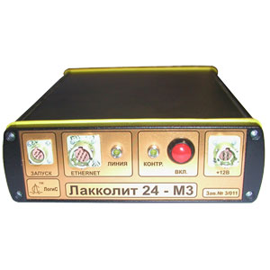
LAKKOLIT X-M4 DIGITAL MULTICHANNEL SEISMIC STATION
LAKKOLIT X-M4 is a digital multichannel engineering seismograph, designed for engineering geological and micro-zonation surveys by refracted wave, seismic refraction and vertical seismic profiling methods. Features •Data rate up to 100 Mb/s •Built-in electronic switchboard •Data recoding and preliminary processing...
-
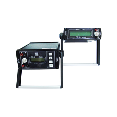
ERA-MAX ELECTRICAL EXPLORATION SYSTEM
ERA-MAX equipment is designed for electrical prospecting on any surface Features •Low-frequency electromagnetic method for measuring resistivity •Operating frequencies: DC, 1.22, 2.44, 4.88, 9.76, 19.52 and 625, 1250, 2500 Hz •Electrical field can be measured by pairs of active...
-
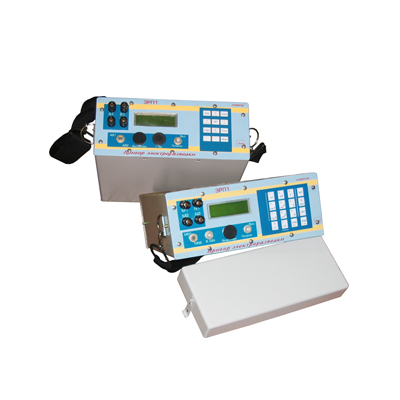
ERP-1 DIGITAL ELECTRICAL EXPLORATION SYSTEM
Portable digital electrical exploration system ERP-1 is designed for geophysical survey performed by the following methods •Electrical exploration by DC and AC resistivity method - vertical electric sounding (VES), electric profiling, signal generator, M3, as well as measuring of the...