CONSTRUCTION SCAN 1700 3D
Construction Scan 1700 3D is a portable, lightweight and easy-to-use GPR system designed for automatic real-time location of pipes, cables, reinforcement, cracks in concrete, brick, wood and other structures at a depth of up to 1 m.
Construction Scan 1700 3D is a portable all-in one GPR solution designed for automated localizing defects in a wide variety of wood,brick and reinforcement concrete structures, at depth of 1 m.
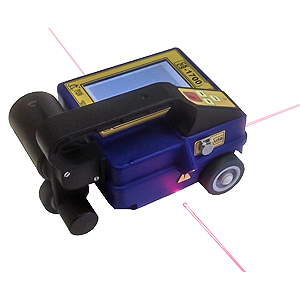
Construction Scan 1700 includes a control processing unit, LCD display, the antenna unit AB-1700 and a power supply unit in one enclosure. The control processing unit provides processing, displaying and saving of the scanning results. CS-1700 accumulates information in the internal 2 GB Flash memory card and transfers it to the PC via the USB interface. There is a special marking rug with a bar code for precision 3D scanning of objects.
| Penetration depth | not less than 1 m |
| Resolution | not less than 30 cm |
| Minimum diameter of detected semiconductor | 0.3 cm |
| Rate of penetration | not less than 1 m/sec |
| Antenna central frequency | 1700 MHz |
| Weight | 1.5 kg |
| Dimensions | 22 x 17 x 14 cm |
| Languages | English, Russian |
| Temperature range | -20°C ... +50°C |
| Running time | 4 hours |
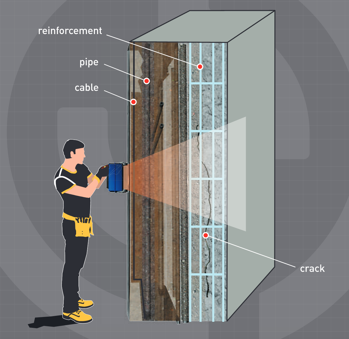
•Detection and location of different defects in reinforced concrete
•Cells, cavities
•Foreign inclusions
•Cracks, layering
•Determination of reinforcement specifications
•Size
•Occurrence depth
•Degree of corrosion
•Detection of buried wiring, cables and communications lines
•Detection of plastic and metal pipelines
•Detection of heterogeneities, anomalies and other buried in solid environment (which wood, brick, reinforced concrete, building constructions, soil, etc)
•Discovering of ventilation and communication channels
•Detection of shelters and covered-up holes
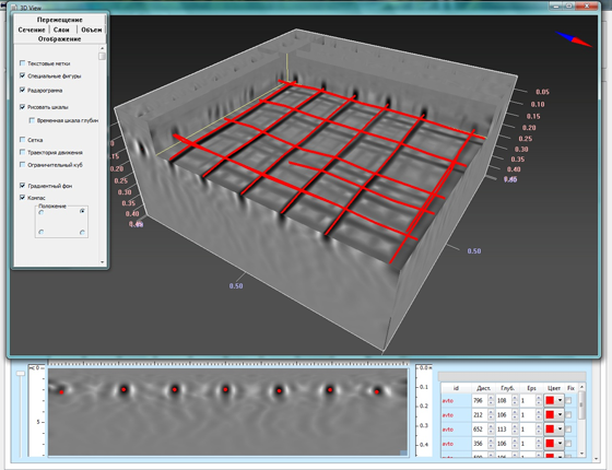
ArmScan 3D
Specialized software ArmScan is a new solution for automated location of reinforcement, cables, pipes. The software allows users to build the utilities (reinforcement, pipes, etc) in 3D. the user can locate defects, different anomalies and other objects.
•All-in-one GPR system
•5" colour display
•3D visualization
•Built-in USB interface
•Internal 2 GB Flash memory card
•Detachable SD-card
•Guiding laser
•Data collection grids (3D system)
•Built-in bar code reader
•Several languages option (Russian, English, Chinese)
•Quickly-detachable Li-io battery 15V